Ground Penetrating Radar (GPR)
Ground Penetrating Radar (GPR) uses high-frequency radio waves to detect and image subsurface features.
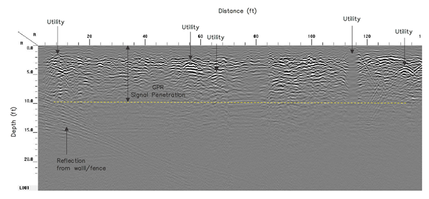
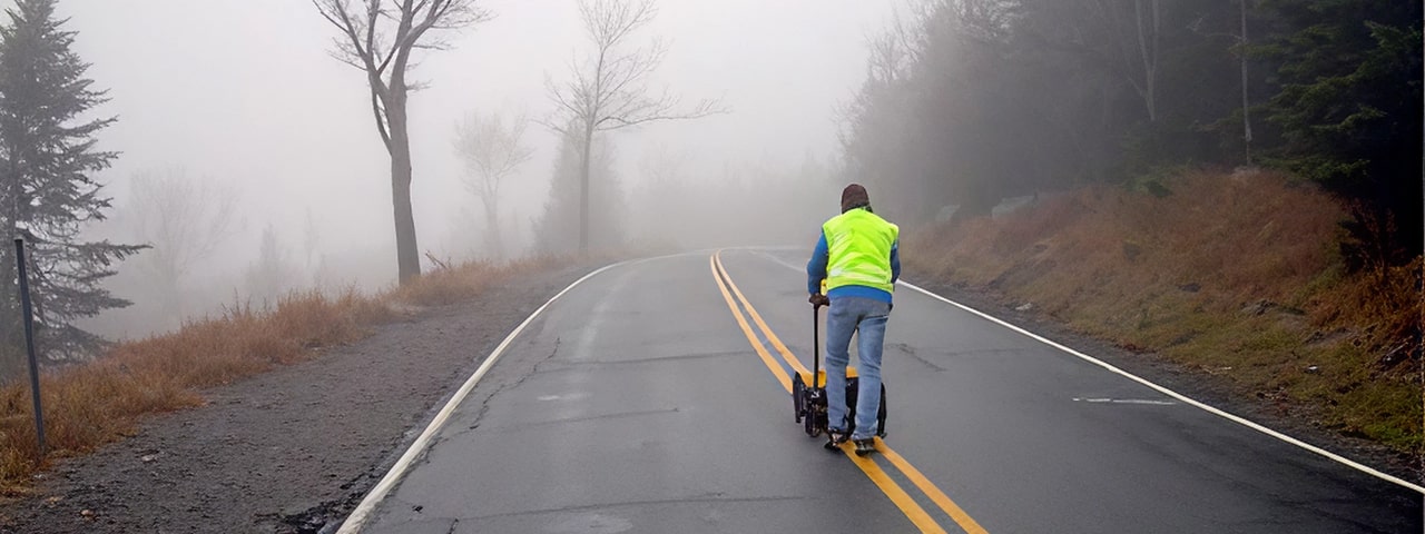
As the GPR antenna is moved across the surface, it transmits electromagnetic signals into the subsurface and receives reflections from interfaces at which changes in the dielectric properties of the subsurface materials occur. The reflections are then amplified, processed, displayed on a screen, and recorded for post-processing. GPR provides a continuous profile of the subsurface.
GPR allows for the acquisition of large amounts of data in a short period of time, making it a cost-effective method for many projects. GPR is commonly used in conjunction with other geophysical techniques such as magnetics, electromagnetic induction, and seismic refraction.
Experience is crucial in the collection and interpretation of GPR data, especially in evaluating the feasibility of GPR investigations where site-specific limitations are present. At HRGS, we have considerable experience and resources to provide you with reliable guidance and accurate data.
Our state-of-the-art equipment complements our experience and often helps overcome site limitations. We own a full complement of systems and antennas for different resolutions and exploration depths. Our real-time display allows us to adjust our field procedures to optimize data collection. Through the use of survey wheels and DGPS integration, the accuracy of positions is improved. The processing software we use allows us to filter out extraneous noise, providing a clearer view of subsurface conditions through profiles, time slices, and 3D imaging.
Applications of Ground Penetrating Radar (GPR) Fast, High-Resolution Subsurface Imaging
Site Assessment & Environmental Investigations
- Pinpoint underground storage tanks, drums, and buried utilities
- Map waste pits, trenches, and landfill boundaries
- Locate contaminant plumes (in favorable soil conditions)
Construction & Infrastructure Support
- Identify voids in the subsurface
- Determine depth to bedrock or water table
- Guide geotechnical and foundation planning with non-invasive profiling
Archaeology & Forensics
- Locate buried foundations, structures, and artifacts
- Support historical site evaluations with minimal disturbance