Electromagnetic Induction
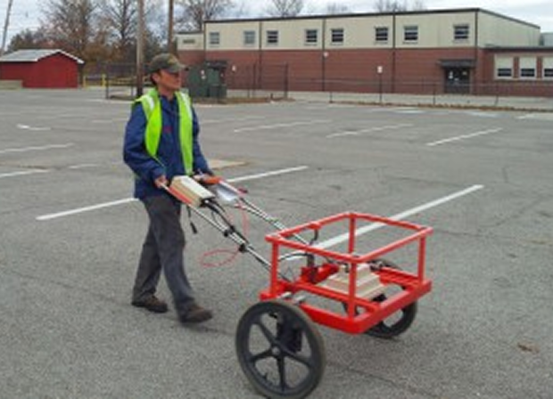
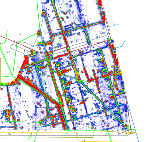
Electromagnetic (EM) induction is a rapid, non-invasive geophysical method used to measure variations in subsurface conductivity by inducing and detecting secondary electromagnetic fields. The method is well-suited for mapping shallow features such utilities, USTs, buried fill/landfill delineation, changes in salinity, and conductive contaminant plumes. EM instruments can collect data while in motion, making them ideal for efficient site coverage over large areas. EM is a valuable tool for site assessments, environmental investigations, and agricultural studies, and utility mapping. EM methods are commonly used as a complement to GPR and PUL surveys. HRGS uses a variety of time domain and frequency domain EM instruments including downhole probes designed for use in open holes or PVC-cased borings.

Applications of EM Induction
Environmental Engineering
Construction and Infrastructure
- Detect and locate buried drums, underground storage tanks, and utilities